Sunday, May 31, 2015

Capitol Reef National Park - Hickman Bridge Hike


The Hickman Bridge Trail is the most popular hike in the park. 


In the off beaten path its possible you could be all alone much of the way.


In fact, Hickman Bridge is used to being alone.  It remained hidden until it was discovered it in 1940. 


The trail offers plenty of visual interests and variety.  Although the trail is 2.2 miles round-trip you travel mostly in the sun so plan ahead and take plenty of water,  


Our first look at Hickman Bridge.


Soon Hickman Bridge comes into full view.  You can see in this photo we were not alone. 


Its magnificent span measuring 125 feet in height and 125 feet in width. 


Many times during our hikes we find special designs in rocks.  I can only imagine how it got this way. 


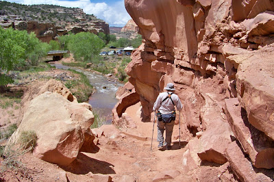
Kathy took this photo to show I really did take this hike.


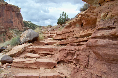
Some of the smooth rock we had to walk across during this hike.  Although the weather forecast was great it seemed to rain every afternoon after 2 p.m. 


Sign indicates a rockfall hazard area and states no stopping for the next 500 feet.  


Here's Kathy walking along the rock hazard area to the parking lot. We both enjoyed this hike. 


Thursday, May 28, 2015

Zion National Park - Kolob Canyon


We decided to stop at the northern portion of Zion National Park on our way to Capitol Reef National Park.  We were planning to spend most of the day exploring Kolob Canyon.  Due to unfortunate weather conditions we only had the opportunity to hike the Timber Creek Overlook Trail.


We thought we could make this 1-mile round trip without carrying any rain gear.  Huge mistake on our part. The trail was muddy and wet most of the way.  We both were pretty wet upon our return.


Kolob Canyons is the northwest section of Zion National Park of Utah, United States. The Kolob Canyons are part of the Colorado Plateau region of the park and are noted for their colorful beauty and diverse landscape.


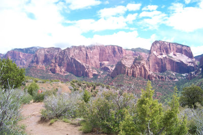
Here in the northwest corner of the park, narrow parallel box canyons are cut into the western edge of the Colorado Plateau, forming majestic peaks and 2,000 foot cliff walls.  


Whether you come to view the panoramic landscape from a scenic drive, hike into one of the majestic canyons, or begin a multi-day adventure into the Zion Wilderness, Kolob Canyons has something special for everyone to experience.


The Timber Creek Overlook Trail follows along a small ridge with spectacular views of the Kolob Canyons, the Kolob Terrace, and the Pine Valley Mountains. In the background lies Timber Top Mountain 8055 feet.


I found a small hole within the mountain.  


I was waiting for the clouds to clear to get a better picture of the mountain ridge.  We really enjoyed our short trip to Kolob Canyon.  


Saturday, May 23, 2015

Nellis AFB - Desert Eagle RV Park

We do not normally showcase military facilities on our blog,  but we thought we would make an exception with this RV Park,  We have been to many military bases and while some RV Parks are excellent we rated this facility as the best of the best.  


This is the layout of the park.  It has four large roundabouts which can accommodate 25 RV's each. The smaller circles on the left are overflow sites which can handle 8 rigs each.  The facility has 148 total sites of which 116 are full hook ups and 32 are partial hook ups.  They also have 50 overflow dry camping sites.


This is the entrance to the park,  It has three spaces to park and register.  These spaces are also used to park overnight if you arrive after office hours.


Here's a photo of the main RV park office. Reservations are accepted six months in advance. 


Here's a vacant site.  Notice the cement pad which can accommodate a 45' motor home. 


Here we are parked in site 13 in circle 1.  The park has two laundry and two shower facilities. 


The rear of the sites are really wide.  The park Wi-Fi is outstanding. 


This is one of the pull through sites.   Looks like you can fit 2-3 motor homes.   


This is a photo of the water and electric only sites.  


Here's the walking trail that goes around the perimeter of the campground which many people use to walk their dogs.  You can see fake grass and pet waste container.  There are multiple pet waste areas and containers conveniently located throughout the park. 


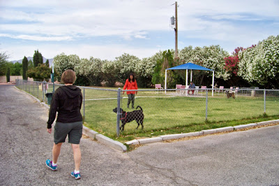
Here's the fenced dog walk area.  This was one of the cleanest pet areas we have ever seen.  The facility has received numerous Air Force awards and commendations. 

Friday, May 22, 2015

Grand Canyon - North Rim Day 2

Uncle Jim Trail 


Kathy at the trail marker.


Uncle Jim Trail begins by climbing gently among the tall trees, running quite close to the rim and offering partial views down Roaring Springs Canyon.    


Our first view of North Kaibab Trail.


This was taken with our camera zoom.  Looks like a bridge you need to cross.  Kathy is not fond of bridges but if you hike this far down the canyon, you definitely do not want to hike back up the mountain.  I think she can make even with her eyes closed.


Some parts of the trail show quite extensive wildfire damage.


Uncle Jim Trail is about 2-1/2 miles long one way.  The views of the canyon and North Kaibab trail get better at the overlook. 


The North Kaibab Trail is the least visited but the most difficult to maintain.   If you click in this photo you can see some of the trial in the center of this photo.  Much of the trail was blasted directly into the cliff. 


The trail is about a 1000 foot higher at the trail head than South Rim trails.


If you click on this photo, you can see a white roof in the center left.  This is the Pumphouse Residence.  


Here I am scoping out the canyon.  


The trail travels steeply in the first couple of miles then evens out to match the quality and grade of the South Kaibab Trail.  

Pictures along the Cape Royal Drive


After a wonderful morning hike on Uncle Jim Trail it was time to do some scenic driving. The turn off for Cape Royal Drive was not far from the North Kaibab Trail parking lot, so it was an easy decision to make!  This photo was taken at the Vista Encantada Viewpoint. 


The drive is 23 miles one way, but with stopping to view the numerous viewpoints and maneuvering the winding road it takes a few hours. Another photo at the Vista Encantada Viewpoint.


The road gets close to the Rim at times.  Kathy said "Slow Down" many times during the drive.  I swear I was not speeding.   


The viewpoints were spectacular, 


I especially like the clouds. 


Don't skip this drive if you make it to the north rim of the Grand Canyon.


.At Walhalla Overlook, you’ll see the Colorado River far below as it twists and turns through the Grand Canyon.

Cape Royal 


We finally arrive at the Cape Royal Marker. 


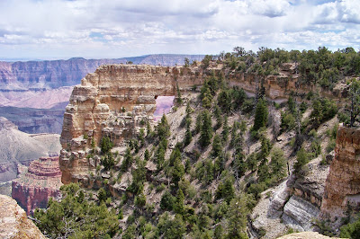
Display for Angels Window.


Here you can see the dramatic hole in the arch.  You can also see visitors along the top of the arch. 


Cape Royal provides a panorama up, down, and across the canyon. 


With seemingly unlimited vistas to the east and west, it is popular for both sunrise and sunset.


The Cape Royal view point has the best views in the park. The Desert View Watchtower on the South Rim can be seen from this point as well as the Colorado River below. We did see the Watchtower with our binoculars. 

The visit to the North Rim brought back many great memories of our hikes of the South Rim of the Grand Canyon.  Do Not miss the opportunity to see the canyon and all its beauty!


Pulling up Anchor at Acadia National Park

 I thought it would be nice to add a few facts about Acadia National in each of the photos below. We decided that our last trip here at Acad...