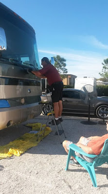
Here we are gearing up at the North Kaibab trailhead. At the trailhead, you are standing on the Kaibab Plateau at an elevation of 8,250 feet. Approximately 1300 feet higher than the South Rim. We both started with 30-32 pounds each in our backpacks.
The trail winds down the canyon 14.2 miles to the Bright Angel Campground. Our trek today will take us approximately half that distance to the Cottonwood Campground.
The first 4.7 miles leads down to Roaring Springs Canyon. From mid-May through October, restrooms, and water may be available along the trail at Supai Tunnel, the Roaring Springs, Manzanita Rest Area and Cottonwood Campground. During our hike water at Supai Tunnel was not available. It's crucial that hikers check to see where water is available prior to beginning any hike down the canyon.
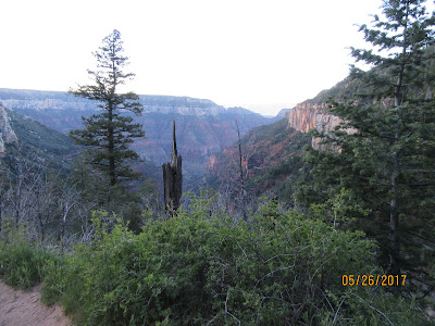
Our first stop is Coconino Overlook about 1.4 miles down the trail. It's a great place to stop, soak in the view and have a snack before proceeding down the canyon.
The word Kaibab means "mountain lying down" in the language of the Southern Paiutes. This photo shows how far we have come down the canyon so far. We are less than 2 miles down at this point.
If you click on this photo to enlarge it, you can see one section of the main water line which provides essential water to the North Rim. Roaring Springs has been the source of water for the North Rim since 1928. Heavy rains frequently cause mud and debris slides that damage these lines which must be repaired as quickly as possible. Every hiker must be prepared just in case water is not available on the trail.
At 2 miles we reach the Supai Tunnel. The Civilian Conservation Corps blasted this tunnel in the 1930's when this trail was built to replace the old Bright Angel Trail.
In the middle of this photo, you can see the bridge in the Redwall. The construction of this bridge took place after a major flood in 1966 which wiped out much of the North Kaibab Trail
We finally arrive at the Redwall Bridge at 5.4 miles. The Bridge traverses Roaring Spring Canyon. Notice the Ponderosa Pine to the right of Kathy. This tree is growing nearly 1000 feet below their range. If the conditions are right, the seeds will germinate which means the plant's minimum requirements are met and life begins.
The Needle. This section was blasted through the sheer Redwall Limestone. During this section, you transverse narrow pathways that will make your hair stand up on end. If you fall, it will be fatal. Here is a link to Kathy's video that shows just how dangerous this path becomes. https://www.facebook.com/kathy.s.cramer/posts/1319682961414001?pnref=story
The white spot in the middle of the photo is Roaring Springs. We are down 5 miles into the canyon. You can hear it way before you see it! It is the lifeline of the North Rim.
The Manzanita Rest Area elevation at 3840 feet. This is the location of the pump house which provides water to the North Rim and a well-deserved rest area for weary hikers. We took about a 20-30 minute break before continuing to Cottonwood Campground.
The park established Cottonwood Camp, elevation 4200 feet, in the 1920's as a layover for mule parties coming down from the North Rim. The mules now only go to the Supai Tunnel and return to the top. I am sure Kathy will provide a detailed analysis of our hike in the near future.
A look back up to the top from Cottonwood Camp. At night, you can see the lights of the Grand Canyon Lodge on the North Rim. The Lodge is on the light colored peak in the center of the picture just above our backpacks hanging on the pole.
This is me, I developed significant pain in my thighs on way down the canyon. I was definitely second guessing my immediate future. Kathy, in the meantime, was in full blown panic mode. After speaking with the Ranger, I proceeded to soak my legs and thighs in the creek that sits adjacent to the campground. I had two choices; retrace our steps back up out of the Canyon or continue our journey. I decide to continue our journey in the hope that things would get better! Day 2, 3 and 4 posts coming soon.
A couple of facts you might not know about the Grand Canyon
WE DON'T REALLY KNOW HOW OLD IT IS
It has long been believed that the Colorado River began
carving the Grand Canyon about 6 million years ago, but a 2012 study contained
a real shocker, suggesting that the process may have begun as far back as 70
million years. In all likelihood, the Grand Canyon as we know it today started
out as a series of smaller canyons 70 million years ago, but the majority of
the canyon did not begin to take shape until much more recently.
THE GRAND CANYON CREATES ITS OWN WEATHER
Of all Grand Canyon facts, this one is pretty cool – no pun
intended. Sudden changes in elevation have an enormous impact on temperature
and precipitation, so the weather you're experiencing could vary drastically
depending on where you are in the Grand Canyon. The coldest, wettest weather
station in the region is the Bright Angel Ranger Station on the North Rim,
while the hottest (and one of the driest) is just 8 miles away at Phantom
Ranch.


