Friday, June 2, 2017

Day 4 of 5 - Grand Canyon Rim to Rim (R2R) Hike - May 29, 2017 - Indian Gardens Campground to South Rim


We knew today was going to be a rough day, so we started again in the dark at 4 a.m.  Our goal was to make it to the start of the uphill climb, which was about a mile and one half, before sunrise. Since we had hiked this on two prior separate occasions , we were both familiar with the trail. 


As one of the widest bands of continuously exposed rock, the Redwall limestone makes travel in and out of the canyon difficult.  Getting through the Redwall is impossible unless you reach a fault line zone that creates a break in this sheer cliff.  


Jacobs ladder, a set of switchbacks below the 3-Mile Rest House, makes use of break created by the Bright Angel Fault.  Climbing these switchbacks is very strenuous with large rocks and large staked wooden planks which reduces erosion of the trial. 


Here we are at 3-hours into our ascent. We are quickly approaching the mile-and-a-half  Rest House a great place to take a break.  


Speaking of breaks, Kathy is resting and having a snack before the big push up the final mile and one-half.  


I have fond memories of the Mile and a half Rest House, as I got to spend the night here with Doyle and Judy on a previous trip up the Canyon.  We had a great time and in the morning successfully completed the hike out the canyon. 


Here is a photo of the staked wooden planks mounted on the trail.  Without these, it would be very difficult to hike up the trail especially for the mules.  


On any hike on the South Kaibab Trail or Bright Angel Trail, you are bound to encounter the mules. They are synonymous with these two trails. The riders seem to come in two flavors. About half are smiling and really enjoying the mule trip while the others can hardly acknowledge you because they are focusing so much on their mule and staying on the trail. I think I would be in the later group if I were on a mule in the canyon! I myself prefer to have both feet on the ground. 


If you click on this photo, you will see an arrow pointing left towards an outline of a face of an Indian Chief who looks over the canyon.  In the above photo,  an Indian guide prays to the Chief for a safe journey for him and his travelers. 


This photo shows the mules on the switchback below us. We are not exactly sure of the true story but this is what I thought I heard. It is said that the Chief sent his granddaughter down the mountain and she never returned.  He then sent other searchers to find his grand-daughter who also never returned so he sits here and watches for their safe return.  


During our accent up the canyon, we meet a man who was having a difficult time and asked us if he could tag along with us to the top.  We said "sure" we are taking it slow and steady, one step at a time.   


On average there are between 300-400 emergency rescues each year at the Grand Canyon making it the most of any of our National Park.   About 4.5 million people visit the Grand Canyon each year, and an average of 12 people die there annually, according to park statistics. The deaths can be attributed to anything from natural causes, medical issues, a suicide, to heat, drowning and traffic crashes


If you click on this photos, you can see approximately where we started 3 days ago.  You can hike the canyon, all  23.9 miles of it or you can drive from rim to rim in about 4 1/2 hours. We prefer to hike it!


Remember the man we helped up the mountain, he is taking our photo.   We cannot tell you how proud we are to add this rim to rim hike to our resume.  We consider it great training for this year's upcoming Amazon season!

Little know facts about the Grand Canyon

THERE'S A TOWN IN THE GRAND CANYON

Lists of Grand Canyon facts don’t often include information about its human population, but surprisingly, it does have one. Supai Village is located at the base of the Grand Canyon within the Havasupai Indian Reservation. Inaccessible by road and with a population of just 208, it is the most remote community in the lower 48 states and is the only place where mail is still delivered by pack mule. 

WE'RE MISSING 950 MILLION YEARS’ WORTH OF ROCKS

The Grand Canyon offers one of the most visible examples of a worldwide geological phenomenon known as the Great Unconformity, in which 250 million-year-old rock strata lie back-to-back with 1.2 billion-year-old rocks. What happened during the hundreds of millions of years between remains largely a mystery.


Thursday, June 1, 2017

Day 3 of 5 - Grand Canyon Rim to Rim (R2R) Hike - May 28, 2017 - Bright Angel Campground to Indian Garden Campground


After a great steak dinner and a wonderful 5 a.m. breakfast, we are ready for an intermediate 5-mile hike up to Indian Gardens.  If you click on the photo you will see the Silver Bridge we crossed to get to the other side of the Colorado River.   

Note:  One thing that I wanted to mention, is Phantom Ranch offers a duffel service that you can request for the mules to carry a sack, not to exceed 30 pounds, up the canyon to the North Rim. Well, that being said, Kathy and I revisited all the items we had in in our backpacks and decided to pay the $75 fee to reduce our weight by 19 pounds.  They could have said $150 dollars, and we would have paid it!


The Silver Bridge was constructed in the late 1960's to support the pipeline carrying water from Roaring Springs to the South Rim. We would have departed Phantom Ranch earlier to beat some of the heat, but we did not want to miss breakfast and we were only hiking just a little over 5 miles.  


The trail follows the river for about a mile and a half before it starts heading up the canyon.  The River Trail also passes through a sand dune habit which tends to make hiking a little harder. 


The Bright Angel Trail and River Trail meet where Pipe Creek enters the Colorado River.  A Rest house which is located here is a great spot for a quick break and snack before you begin your climb.


The portion of the trail from Phantom Ranch to Indian Gardens gains 1400 feet in elevation.  The rule in the Canyon is pack in, pack out.  Which means take everything including your trash with you when you leave. 
   

The majority of the gain is hiking the brutal Devil's Corkscrew which you can see below us. It is a series of switchbacks that appear to never end.  You will definitely take a few breaks ascending this section of the trail.  


This is a photo taken from the top of Devils Corkscrew looking back down to where it begins to ascend.  Mighty glad we finished this section.  


We are very close now to Indian Gardens an oasis in the canyon.  


The campsites here are outstanding.  You can see we have a framed cover over our picnic table and an abundance of shade for most of the day.  We were careful to select the right campsite where late in the afternoon the sun is shielded by canyon walls.  Rest and relaxation are the new order of business.  


There was a group of ladies camped next to us at Indian Gardens.  I took this shot to see what the commotion was going on down below us.


Finally, got to see all the excitement.  A mule deer decided to stop by for dinner.  


The nightly star show at the Canyon was incredible!  Every night in the campgrounds we were amazed to see the beauty of the night sky. 


A couple of facts you might not know about the Grand Canyon


THERE ARE LOTS OF OTHER FOSSILS IN THE AREA

While the dinosaurs might have missed out on seeing the Grand Canyon, lots of other fossils have been found that suggest other creatures frequented the location. They range from ancient marine fossils dating back 1.2 billion years to fairly recent land mammals that left their remains in Canyon caves about 10,000 years ago.

FISH ARE RELATIVELY UNCOMMON IN THE GRAND CANYON.

Prior to modern flood control measures, the Colorado River provided a uniquely difficult habitat for fish, with heavy silt, frequent floods, and temperatures ranging from extreme heat in summer to sub-freezing in winter. As a result, only eight fish species are native to the Grand Canyon, six of which are found nowhere outside of the Colorado River.

Day 2 of 5 - Grand Canyon Rim to Rim (R2R) Hike - May 27, 2017 - Cottonwood Campground to Bright Angel Campground (Phantom Ranch)


Day 2 of our hike was a relatively flat hike of 7.2 miles.  However, the last 2 miles of the trek is through what is known as "the box".  This section enters a narrow canyon with walls that tower over the North Kaibab Trail.  The temperatures inside the walls reach in excess of 130 degrees.


Since I wanted to make sure that we got through the box early, we decided to awake at 3:15 a.m. and be on the trail by 4 a.m.  We decided that I would lead the hike so Kathy could keep an eye on me. 


The rest and stretching I did yesterday paid off.  My legs felt fine and we are on our way.   Once you leave the campground you encounter typical desert vegetation as you see to the right of me. 


The trail is much flatter. The climate is hot, and annual precipitation measures less than ten inches per year.  Water is most precious


Poisonous but beautiful sacred datura is also a common plant in the desert below Cottonwood Campground,
.  


The most widespread desert tree mesquite grows about fifteen feet tall and is abundant in this area.  They adapt to this dry environment by sending down roots to depths between thirty and one hundred feet.  


It is recommended that hikers reach the Bright Angel Campground before 10 a.m daily. 


Although not in this photo, we wanted to visit Ribbon Falls, a true gem about 1.6 miles down from Cottonwood Campground, but since I had such an issue with my legs yesterday we decided to pass.  Hikers caught in the heat of the day are encouraged to take a siesta there from 10 a.m to 4 p.m,

  
 Though the trail here is not challenging from a perspective of elevation. The gorge of black rock becomes like an oven and can be compared to walking through a parking lot in Phoenix or Las Vegas in the summertime. 


As you can see here, we are starting to enter the inner gorge, a narrow canyon boxed in on either side by 1.7 billion-year-old Vishnu Schist where over 1 billion years of geology is missing, 


Our history lesson for today.   Do you know the difference between a canyon and a gorge?


A canyon is wider than it is high and a gorge is deeper than it is wide.  If you got it right give yourself one point!


Although not common, the Grand Canyon Rattlesnake can occasionally be seen along the North Kaibab Trail.  We did not see any snakes but Kathy did, however, dream that she encountered one on the trail and I simply told her to  "just step over it"


In this photo, you can see the Bright Angel Creek.   In addition to other survival items we brought along, we did purchase a survival straw that we could use to purify water just in case of an emergency,


One thing we did do that helped immensely was to soak our bandanas in the creek and wrap them around our necks to keep cool during our hikes.   


Did I mention that our packs weigh between 30-32 pounds each?  After hiking 14.2 miles you think you did pack the kitchen sink. 


You can see here that the sun is starting to rise and enter the canyon. 


The sign indicates Phantom Ranch is just 3/4 miles ahead. 


After fourteen long trial miles from the North Rim, Phantom Ranch is indeed a welcome sight.  By arriving at  8:30 a.m. we beat the heat.  Another reason that I was glad I was here, is that Kathy arranged steaks dinners for us at 5 p.m. 


Yep, it's me,  soaking my legs and cooling off.  You can only imagine how good it feels!


Kathy taking a well-deserved rest as well.  The temperatures here at Phantom Ranch were in excess of 110 degrees in the sun.  Looking for shade did little to help.

A couple of facts that you might not know about the Grand Canyon:  

IT'S NOT THE DEEPEST CANYON IN THE WORLD
The Yarlung Tsangpo Grand Canyon in Tibet plummets to a depth of 17,567 feet, making it more than 2 miles deeper than the Grand Canyon's 6,093 feet. The Tibetan canyon is also about 30 miles longer than the Grand Canyon

THERE ARE NO DINOSAUR BONES IN THE GRAND CANYON
The Grand Canyon might look like the perfect place to go looking for dinosaur bones, but none have ever been found there and for good reason. The rock that makes up the canyon walls is vastly more ancient than the dinosaurs – about a billion years more ancient, in some cases – but the canyon itself probably didn't form until after the dinosaurs were long gone.

Wednesday, May 31, 2017

Day 1 of 5 - Grand Canyon Rim to Rim (R2R) Hike - May 26, 2017 North Rim To Cottonwood Campground


Here we are gearing up at the North Kaibab trailhead.  At the trailhead, you are standing on the Kaibab Plateau at an elevation of 8,250 feet. Approximately 1300 feet higher than the South Rim. We both started with 30-32 pounds each in our backpacks.


The trail winds down the canyon 14.2 miles to the Bright Angel Campground.  Our trek today will take us approximately half that distance to the Cottonwood Campground. 


The first 4.7 miles leads down to Roaring Springs Canyon.  From mid-May through October, restrooms, and water may be available along the trail at Supai Tunnel, the Roaring Springs, Manzanita Rest Area and Cottonwood Campground.    During our hike water at Supai Tunnel was not available.  It's crucial that hikers check to see where water is available prior to beginning any hike down the canyon.


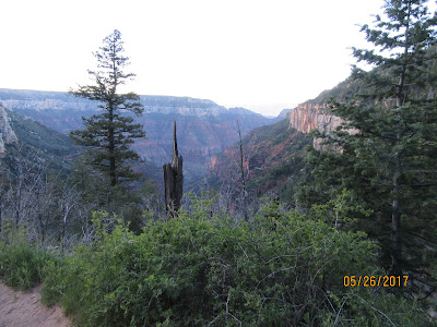
Our first stop is Coconino Overlook about 1.4 miles down the trail. It's a great place to stop, soak in the view and have a snack before proceeding down the canyon.


The word Kaibab means "mountain lying down" in the language of the Southern Paiutes.  This photo shows how far we have come down the canyon so far.  We are less than 2 miles down at this point. 


If you click on this photo to enlarge it, you can see one section of the main water line which provides essential water to the North Rim.  Roaring Springs has been the source of water for the North Rim since 1928.  Heavy rains frequently cause mud and debris slides that damage these lines which must be repaired as quickly as possible.  Every hiker must be prepared just in case water is not available on the trail. 


At 2 miles we reach the Supai Tunnel.  The Civilian Conservation Corps blasted this tunnel in the 1930's when this trail was built to replace the old Bright Angel Trail.  


In the middle of this photo, you can see the bridge in the Redwall.  The construction of this bridge took place after a major flood in 1966 which wiped out much of the North Kaibab Trail


We finally arrive at the Redwall Bridge at 5.4 miles. The Bridge traverses Roaring Spring Canyon.    Notice the Ponderosa Pine to the right of Kathy.  This tree is growing nearly 1000 feet below their range.  If the conditions are right, the seeds will germinate which means the plant's minimum requirements are met and life begins.  


The Needle.  This section was blasted through the sheer Redwall Limestone.  During this section, you transverse narrow pathways that will make your hair stand up on end.  If you fall, it will be fatal.   Here is a link to Kathy's video that shows just how dangerous this path becomes.  https://www.facebook.com/kathy.s.cramer/posts/1319682961414001?pnref=story


 The white spot in the middle of the photo is Roaring Springs.  We are down 5 miles into the canyon. You can hear it way before you see it!  It is the lifeline of the North Rim.


The Manzanita Rest Area elevation at 3840 feet.  This is the location of the pump house which provides water to the North Rim and a well-deserved rest area for weary hikers.  We took about a 20-30 minute break before continuing to Cottonwood Campground. 


The park established Cottonwood Camp, elevation 4200 feet, in the 1920's as a layover for mule parties coming down from the North Rim.  The mules now only go to the Supai Tunnel and return to the top.  I am sure Kathy will provide a detailed analysis of our hike in the near future.  


A look back up to the top from Cottonwood Camp.  At night, you can see the lights of the Grand Canyon Lodge on the North Rim.  The Lodge is on the light colored peak in the center of the picture just above our backpacks hanging on the pole.


This is me, I developed significant pain in my thighs on way down the canyon.  I was definitely second guessing my immediate future.  Kathy, in the meantime, was in full blown panic mode.  After speaking with the Ranger, I proceeded to soak my legs and thighs in the creek that sits adjacent to the campground.  I had two choices; retrace our steps back up out of the Canyon or continue our journey.  I decide to continue our journey in the hope that things would get better!  Day 2, 3 and 4 posts coming soon.  


A couple of facts you might not know about the Grand Canyon

WE DON'T REALLY KNOW HOW OLD IT IS

It has long been believed that the Colorado River began carving the Grand Canyon about 6 million years ago, but a 2012 study contained a real shocker, suggesting that the process may have begun as far back as 70 million years. In all likelihood, the Grand Canyon as we know it today started out as a series of smaller canyons 70 million years ago, but the majority of the canyon did not begin to take shape until much more recently.


THE GRAND CANYON CREATES ITS OWN WEATHER


Of all Grand Canyon facts, this one is pretty cool – no pun intended. Sudden changes in elevation have an enormous impact on temperature and precipitation, so the weather you're experiencing could vary drastically depending on where you are in the Grand Canyon. The coldest, wettest weather station in the region is the Bright Angel Ranger Station on the North Rim, while the hottest (and one of the driest) is just 8 miles away at Phantom Ranch.


Pulling up Anchor at Acadia National Park

 I thought it would be nice to add a few facts about Acadia National in each of the photos below. We decided that our last trip here at Acad...