Monday, September 11, 2023

Schoodic Summit Hike - Acadia National Park


The Schoodic Peninsula is the only part of Acadia National Park found on the mainland of Maine. It takes about an hour drive from our campground to get here.   We decided to hike three different routes today as a loop to get to Schoodic Summit - Anvil, Schoodic & Alder.


It is also managed by the national park services but has fewer visitors. It still boasts granite ridges, granite stairs and most features as other hikes we have completed in Acadia national park. 


We also have to navigate many tree roots as well. 


This trail rises abruptly uphill and downhill along our route.  


We have a few switchbacks on the way up the mountain. 


Did I mention granite steps.  Hiking down them is not my favorite part of the hike.  It does hurt the knees. 


We did have to hike down some trails only to hike back up again.  The last .3 miles was decidedly uphill. 


We finally arrive at the summit, but you have to travel to the overlook for the views which is another .2 miles.  


View from the Overlook of the Winter Harbor Lighthouse built in 1856.  It's now privately owned and not opened to the public. 


The Bar Harbor, Maine cruise port is a tender port of call, meaning cruise ships anchor a short distance offshore and passengers are ferried to the port terminal in smaller tender boats. From our vantage point we also had views of Cadillac Mountain and Frenchmen's Bay.
 

Kathy found and photographed an 1860 geological marker near the overlook. 


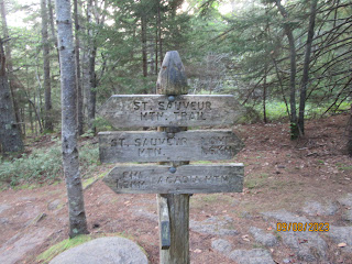
You can get confused with all the trail markers. I decided to point to our direction of travel on the way back. 


We had to take the Schoodic Trailhead back to the Alder trail on our return. 

 
A long wooden path to cross over a wet section on our return.  It did rain a day earlier but not much accumulation. 


We reach the Alder Trailhead.  We have .6 miles to go. 


After hiking up and down on the way up to the summit, we have a nice wide-open flat trail to complete our hike.  


 Our final totals for this hike.  


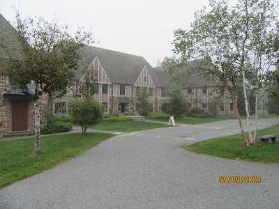
The Peninsula is also the home to the Schoodic Research Learning Center. A place for science learning in that it enhances the understanding of the natural and cultural resources of the National Park System.  The building was converted from a closed Naval facility.


Friday, September 8, 2023

St. Sauveur Mountain Hike Loop - Acadia National Park


After watching our 2nd sunrise at Cadillac Mountain Sumit, we decided to hike the Sauveur Mountain Loop.  The weather on the sunrise trip was 30 degrees warmer than our previous trip which was in the low 40's with 25 mph winds.  We brought blankets and seats to be more comfortable, Overestimated!  Weather was 73 degrees at the top. 


Just south of Acadia Mountain, St. Sauveur Mountain is a larger formation that makes for a pleasant and not-too-strenuous day hike.


A granite path leads the way up the mountain. Good hiking shoes is a must for all the trails in the park. 


We started the "St. Sauveur" trail near the Acadia Mountain Trailhead which is roughly a mile north of the main St. Sauveur trailhead.


The trail heads southeast and slowly make its way up the mountain.


We walked through narrow trails with many spider webs along the path. 


Had a great photo of a spider web. On average, it takes 30 to 60 minutes for web building spiders to weave a web. Even though spider webs are extremely strong, they don't always last for long.


We came upon a wooden path to walk. This path is welcomed after rains. 

We finally arrive at the summit marker. They say don't be disappointed at the lack of a view; the views will be coming up soon enough.


To see the views, you need to hike to the Valley Peak. 


We finally arrive at Valley Peak however, due to the foggy conditions, we could not see Southwest Harbor nor Greening Island. A bit disappointing but not so unexpected.  During our sunrise trip Bar Harbor was totally fogged in. 


We started our hike back up to the summit. We traveled the Valley Peak loop counterclockwise but would recommend hiking it clockwise for the best views. 


We traveled along the Man o' War truck road trail on our return. 


We finally reached our last trail marker. The trail slowly descends the forested north face of St. Sauveur Mountain and intersects with the "Man o' War Truck Road. 


Kathy uses Map my Walk by Under Armor which tracks our path along the route. 


It also tracks distance, duration, calories and steps.   Although we did not see some amazing views, the hike was well worth the effort.  We certainly passed our 10,000 steps a day. 


Beech Mountain South Loop - Acadia National Park


Kathy leading us on a short moderate loop of Beech Mountain on the west side of Mount Desert Island.  


All of the hikes in Acadia NP involve hiking up mounds of granite boulders, slopes and steps made with granite. 


I did say rocky trails, granite stairs and slopes. This hike was a short distance of 1.2 miles each way.


Max, our kayak guide, suggested this hike for the amazing views at the top. 


A look towards Somes Sound. 


We had views of Long Pond and Mansell Mountain on the way up and access to one of the few remaining fire towers in the area. 


The first platform of the fire tower is open and provides views of Somes Sound, Echo Lake, Acadia Mountain, and other mountains on the east side of the Mount Desert Island. I decided to climb to the first platform for a look. 


My views from the first platform. 


Somes Sound. 


I did hear Max say this is a great location for a sunset.


Starting our hike back down the trail. 


Our trail marker back to the parking area. 


Long Pond on the east side of Mount Desert Island.  A short hike but well worth the effort. 


Wednesday, September 6, 2023

Maine State Sea Kayaking - Southwest Harbor


Yesterday, we traveled by jet propulsion for Whale Watching; today we make our own propulsion.  We arrive at Maine State Sea Kayaking, a 5-minute drive from our RV campground for tandem kayaking in Southwest Harbor.   We have to arrive 40-minutes early to get fitted for our life vest and get some training for our kayaks. 


Our shuttle for today with kayaks on the trailer ready to go.  There will be six two-person kayaks in our group.   We choose the Southwest Harbor location because its less active than at Bar Harbor. 
 

We sit and get ready as the kayaks are off loaded.    Our guide for today's trip was Max


To load the kayak, the front passenger sits on the kayak to stabilize it while the rear passenger gets aboard.  We decided the Kathy would handle the rudder by foot control while I took pictures up front and provided the primary oar power.  


We do need our oars before heading out.  We were also provided skirts to keep water from coming into the kayak.  You fold them along a ridge to keep them attached and you dry. 


 The average tandem kayak measures between 18 and 20 feet long. Tandem kayaks are designed with a wider base, making them less prone to tipping over and providing a more stable paddling experience.


I took this photo as we were testing our kayak for control and turning.  The rudder makes turning easier. 


And we are off. We departed from Seal Cove heading North.  We were headed into the wind and against the incoming tide.  It was much easier heading back since the wind was behind pushing us.  


Photos of our other companions.  Why are tandem kayaks called divorce boats?
They jokingly call these “divorce boats” because some couples fight over which way they are going. Unlike a tandem bike where the pedals move at the same time regardless of what each partner is doing, the paddling pair must really work well together to make it down the river.


Max did a great job with our mandatory training and talking about the wildlife we saw along the route.  We did see several different bird species, a seal and two eagles. He also provided information about our surroundings such as the mountains and coves. 


After kayaking about 2.5 miles, we got a chance to unload and stretch our legs, it was also time for a needed rest and snack. 


We did see this sailboat, when we started back to Seal Cove. 

 It's hard to show our exact route on this map.   We departed Seal Cove, traveled North along Mt Desert Narrows to Great Cove where we took a break and headed back to Seal Cove.  The 5-mile round trip was just the right distance. Although we took rain jackets, they were never needed, the weather was excellent.  We had a great time.   

2026-08-02 Quiet Times Golf Outing - NY

  A great time was had by all at the golf outing most of us thought would be cancelled due to rain!  Sonya Meisner knew better!  Thank you t...