Thursday, March 31, 2011

Phantom Ranch - March 28-29th 2011

CLICK ON ANY PHOTO TO ENLARGE

Welcome to Phantom Ranch. Having descended more than a vertical mile below the rim of Grand Canyon, you have reached the bottom of one of the largest canyons in the world. The ranch continues to be one of the most popular destinations in the national park system; its accommodations are often sold out for a year in advance.   The only modes of access to the ranch are by foot, mules or rafting the Colorado River. The two suspension trail bridges near the ranch are the only Colorado River crossings within a 200-mile distance.
This is one of the first views of the ranch when hikers arrive. Designed by Mary Colter and constructed in 1922, Phantom Ranch provided food, lodging, and comfort against an austere backdrop.  The site now includes cabins, two male and two female dormitories, a restaurant (serving only people who book meals ahead of time), a mule corral, emergency medical facilities, and a park ranger station.  The ranch can accommodate about 92 people on a nightly basis. 

These are the only two cabins that have a queen beds for lodging.  Kathy and I were extremely lucky to obtain cabin #2 on the left.  The cabins have heat and AC along with an inside toilet and a small cold water sink.  The showers are only a short walk away.


Here's Kathy enjoying her chocolate cake after our wonderful steak dinner. Everything here is brought in and out by mules.  This is the last place in America where the mail is delivered and taken out by mule. 


Somewhere up there is our destination for tomorrow's hike out. Time for a good night's sleep.

Grand Canyon South Kaibab Trail - Down on March 28th 2011

CLICK ON ANY PHOTO TO ENLARGE
The trail head for the South Kaibab Trail is located off of the Yaki Point Road, which is closed to private vehicles.  The free Grand Canyon National Park shuttle bus is the only way to access the trail head. Many people underestimate this hike because it is all downhill.  We can tell you we certainly feel every muscle used for our hike that descended 4740 feet.

Here's Dave with his 20-pound pack and hiking sticks ready for the plunge.

As you can see the trail has some ice and snow left over from old man winter.  We were very lucky to have excellent weather for our trip down the mountain.


Here's Kathy with her 12 pound pack enjoying a view of the canyon below.  We had packed smartly anticipating any weather or condition changes which happen quickly in the canyon. We had heard that rock slides frequently occur during seasonal changes.

 
Here you can see other hikers along the trail.  Notice that this portion of the trail is outlined and more defined.

Here's a view of where our hike began. Elevation at the top is 7260 feet.

Through the first ¾ mile, the trail cuts through the eastern side of Pipe Creek Canyon until Ooh-ahh Point, where the canyon walls turn around Yaki Point and the view of the eastern canyon opens up. The point is named after a common reaction to the view

Here you can see Phantom Ranch but you still have a few more miles to travel.  This photo better shows the typical steepness next to most of the trail.  The slope of the trail averages 12% overall with some segments as high as 15%.

Here's a great shot of our first glimpse of the Black River Suspension Bridge over the Colorado River.  This bridge is the one used by the mules because they cannot see the river through the bottom of the bridge.  Kathy liked that too! 
 
Building the bridge in the remote and difficult-to-access Inner Canyon posed hazards and challenges to construction. Motorized vehicles such as cars and trucks could not access the deep recesses of the canyon along the river, so all materials were transported by mules or human power. National Park Service mules carried most of the 122 tons of materials for the construction of the bridge into the canyon. The one-ton, 550-foot- long suspension cables were carried down the canyon on the shoulders of 42 Havasupai tribesmen who walked single file down the trail while carrying the cables. They carried the cables over nine miles of trail and down over 4,000 feet from the rim.
 We finally arrive at Phantom Ranch.  The hike down took us 5 hours and the elevation change was 4598 feet.  We arrived at 12:30 and were napping in our cabin by 1:30 with two alarm clocks set to wake us up for our Steak dinners at 5:00 p.m.


Thursday, March 3, 2011

In Loving Remembrance March 2011

We think of you in silence and often speak your name, But all that's left to answer is your picture in a frame, If we could have one lifetime wish, One dream that would come true, We would wish with all our hearts for yesterday and you. If tears could build a stairway and heartache make a lane, We would walk to anywhere to be with you again.
(author unknown)

Kathy's Dad on the Wii balance board.  Actually he was pretty good.

Kathy's Dad with his pulling team.
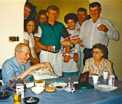
Kath's Dad and a family gathering

Dave and his Mom

Dave his Dad and his son

Dave's brother Billy

Dave's friend Harry Gaffney
Our friend Leo
Casey in one of his favorite lounge chairs
Casey at Christmas
Kitty

Kitty always loved rolling in the grass or dirt.

Telegraph Pass Hike - January 2011 (Updated March 2011)

During our visit to Yuma we hiked Telegraph Pass. As you can see, it was a mile and one-half walk just to get to the trail head from the north frontage road.  Telegraph Pass is located in the north Gila mountain range.  The elevation at the top is 1558 feet.  The hike is 5 miles round trip.  Average hiking time is about 3 and 1/2 hours.  You can see the city of Yuma in the background. 


Here is Dave leading the way to the top.  Kathy and I hiked this pass 3 times during our visit to Yuma.
Here is our neighbor Dale Schmidt who made the hike with us. At the top of the peak sits 366 government and privately owned radio transmitters and other communication equipment.  The winding paved road from the trail head to the top of the mountain was built to allow companies to service their equipment.


Dave is getting a snack while Kathy opens a metal container which holds a guest log book to document your hike.  Kathy always attends to the paperwork!


                           Here we are after another successful hike.


Here we are on March 9th with friends Chuck and Dodi before leaving for our hike.

Chuck and Dodi at the top. 

It was much easier walking down the hill than up!

A fellow hiker was kind enough to take a picture of the four of us during our decent down the hill.  After some lunch and a short nap we were ready for the afternoons festivities.

Pulling up Anchor at Acadia National Park

 I thought it would be nice to add a few facts about Acadia National in each of the photos below. We decided that our last trip here at Acad...