Friday, June 3, 2011

Panorama Trail Hike from Glacier Point - June 2011


We started our hike up at Glacier Point. We had our traveling companions David and Gloria Hood drive us up to Glacier Point after parking our van down in the valley.  When you're up at Glacier Point and you look over the gorge to the waterfalls the Panorama trail takes you over to those waterfalls. To the top of them and down into Yosemite Valley.


 Initially the trail head was a little hard to find, but you can see here that once we found the trail it was fairly open and we had no problems along the rest of the hike.


At 2.61 miles you come to Illiloutte Falls, Illiloutte Falls is sometimes called the "hidden falls" since it cannot be seen from Glacier Point or from the valley floor. About a mile and a half into the hike, Illiloutte Falls comes into view.  A fellow hiker sits on the edge having a great view of the falls.


 After Illiloutte Falls the trail begins to climb allowing great views of Yosemite Valley.  In this photo you can see the top section Yosemite Falls.  We estimated that we climbed back up 1000-1200 feet before starting to descend again.  The trail has asphalt pavement remnants running nearly-continuously from Illilouette Creek to Nevada Falls.

In addition to great views of the lower valley, we had an excellent view of Half Dome.   In the summer there are cables up which assist climbers to hike up to the top of the dome.  This is one of the most popular and demanding climbs in the park.  They only allow 70 climbers at any one time to ascend the mountain. From Yosemite Valley, it encompasses a 4,800 foot gain in elevation over a 8.5 mile trail.


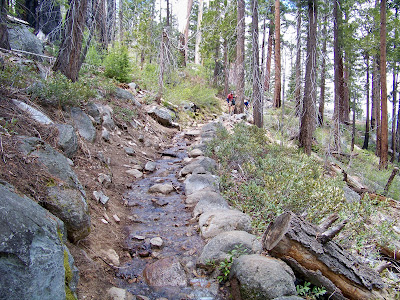
On our way down the mountain we came across several man-made stream beds to help funnel water down.  There was plenty of water in the stream as Yosemite had an impressive snow season this year.


Here you can see fellow hikers negotiating about a 40 foot section of water filled trail.  Kathy and I had already managed this area.


The hardest part of the hike for us was from Nevada Falls to Vernal Falls. It is all downhill on steep steps and we were tired. Very hard on the knees. But the view made up for the shaky legs and we found the Panorama trail to be a superior hiking trail.  We considered this hike to be comparable in difficulty to the South Kaibab Trail at the Grand Canyon.


Both Nevada Falls and Vernal Falls made a great deal of noise for the amount of water in them. Nevada could be heard from many parts of the trail, but Vernal's noise was pretty much confined to the canyon below it.

We hiked this trail on June 1, 2011. There was no crowd on the trail until we hit Nevada and Vernal Falls. We felt like we had this hiking trail all to ourselves!  At first, you cannot tell how long the staircase is and just when it looks to end to a dirt trail, it begins again. The trail descends 1000 feet to the bottom via over 600 steps of steep granite steps. When I started this post, I decided to search the Internet to see if I could find just how many steps we had to deal with. 

You can see the impressive white water in the falls.  It was intense to say the least.  Many signs were posted throughout the trail to remind hikers to stay out of the water.   


At the top of Nevada Fall, the trail joins the Mist and John Muir Trails to Happy Isles. We decided to return via the Mist Trail.  Had I known what Kathy knew about this part of our trip,  I might have suggested we take the easier John Muir Trail.  The Muir Trail eliminates the two waterfalls. You have to remember we hiked 6.14 miles to this point. After the hike, I was glad we decided to see both waterfalls. 


Railings lead from the trail downhill to the brink, where you can see the Merced River free-falls 317 feet.  The railings which were used to hold onto as you descended were a welcomed site.  Several railings along the route were wet from the mist of the falls and very slippery. 


It's a 3-mile demanding round trip hike with a elevation gain of 1000 feet to the top of Vernal Fall from Yosemite Valley. 


They don't call it the Mist Trail for nothing, prepare for slippery footing and a tremendous amount of waterfall spray.  We were very tired when we arrived at this point.  I just remember trying not to trip on any steps.  I did not even turn around to check and see how Kathy was navigating the steps.


Here's a posting of other hikes that can be done in the High Sierra Area.  You don't know how much I appreciated seeing this sign post.  It meant the end of our hike!  The hike took us 3 hours and 40 minutes of actual moving time.  We used another hour plus to stop, take pictures, eat lunch, eat snacks and rest.  We both truly enjoyed the hike but I don't think I will be doing it again any time too soon.


Glacier Point - May 2011


The Glacier Point Road, which provides the only access by car to the top of the point, was closed the first week of our visit.  It opened on Memorial Day weekend and we very glad it did.  The view from the top of the point to Yosemite Valley and beyond is incredible.  You can see the snow piles on the side of the road.


During our ride up with friends David and Gloria we happened upon a Mother Bear (Sow) and two cubs.


Don't you just want to take one home with you. They are so cute and cuddly.


Anyway, at the top the view is outstanding.  The viewpoint is 7200 feet down to the valley and beyond. 


Here we are next to a railing.  You know Kathy would never be this close to the end without a railing!


This photo shows both the Nevada and Vernal Falls.


The upper Nevada Falls drops some 594 feet. 


The lower Vernal Falls drops 317 feet.

You can see Half Dome on the right side of this picture. Half Dome can be climbed when the
cabled ladder system that enables climbers to negotiate the 425-foot sheer granite dome to and from its summit.


In this photo you can see Yosemite Falls and the valley below. The view is as impressive as it looks.

Thursday, June 2, 2011

Yosemite National Park - May 2011

Here I am waiving to my adoring fans, that would be me, while at the entrance to Yosemite National Park.
Yosemite National Park, one of the first wilderness parks in the United States, is best known for its waterfalls, but within its nearly 1,200 square miles, you can find deep valleys, grand meadows, ancient giant sequoias, a vast wilderness area, and much more.

 
A photo of us at the Mariposa Grove at Yosemite which contains hundreds of sequoias.  There are two other smaller groves of sequoias here at Yosemite - the Tuolumne and Merced which each hold a dozen trees.

Another uprooted sequoia tree.  Looks a little like Kathy's hair on a bad hair day.
  The famous clothespin tree in the Mariposa Grove. This tree is hundreds of years old and has survived numerous forest fires.  The fires have systematically burned out the interior portions of the tree without killing it.
Here are some friends we met along the route.  Looks like I got the wrong side of them. 


Heading to Yosemite Valley, you need to go through a tunnel, known as Wawona tunnel. Out from Wawona tunnel, you'll enter Yosemite Valley. The view from the point outside of the tunnel is known as "tunnel view". That point is one of the most favorite picture taking points in the park.


This is the breathtaking photo of Yosemite Valley from the other side of the tunnel.  It looks like a priceless painting but it's Yosemite in all its glory.  You can see Bridalveil Falls below Cathedral Rocks along with El Capitan, large granite cliff on left and Half Dome way in the back center of the photo.


Here's a close up photo of Bridalveil Falls.  It falls some 617 feet and flows year round.   The Ahwahneechee tribe believed that Bridalveil Fall was home to a vengeful spirit named Pohono which guarded the entrance to the valley, and that those leaving the valley must not look directly into the waterfall lest they be cursed. They also believed that inhaling the mist of Bridalveil Fall would improve one's chances of marriage

El Capitan is a 3000-foot vertical rock formation in Yosemite and is a favorite for experienced rock climbers. Many people visiting the park just set and watch the climbers for hours. Once considered impossible to climb, El Capitan is now the standard for big-wall climbing


Yosemite Falls is the highest measured waterfall in North America. The total 2,425 feet from the top of the upper falls to the base of the lower falls qualifies Yosemite Falls as the sixth highest waterfall in the world.  During our visit the falls was at its peak. 


You can see the plentiful water flow in this short video of Yosemite falls.

Saturday, May 21, 2011

Kings Canyon National Park - May 2011

National Parks are amazing places where exercise is disguised as adventure, and you sneak in some learning too. You expect giant trees and a  huge canyon and you won’t be disappointed.  Yet the whole of these parks is even greater than the sum of its famous parts.

You can see the towering trees along the roadway into Kings Canyon.  “Nature’s peace will flow into you as sunshine flows into trees,” said naturalist John Muir back in 1898.  Just driving into the park you start to get a feeling of being consumed by the massive sizes of the giant sequoias. As you go through this magnificent park some aspects of this special place is likely to stir your interest.

Here is a map of the Grant Tree Loop.  You can walk the ½ mile loop to see amazing features of the Grant Grove.
The General Grant tree at Kings Canyon is the third largest sequoia tree in the world and is estimated to be more than 3,000 years old.  Located in Grant Grove, the General Grant tree was nicknamed the Nation's Christmas tree by President Calvin Coolidge, and remains one of the most popular attractions in Kings Canyon National Park.


The fallen Monarch is a giant fallen Sequoia tree that is hollow inside. You can walk through the tree, and get a feeling for the immense size of these giants. One wonders how long ago this tree fell. A high tannin content make this great sequoia wood indigestible to fungi, bacteria, insects and other decay.  This decay of the wood takes place very slowly.  This fallen Monarch has remained virtually unchanged for well over 100 years and who knows how much longer. 

This is a photo taken from the other side of the fallen Monarch. You can see visitors waiting their chance to walk through the tree.

Look at Kathy standing in front of another fallen sequoia trunk.  You can see how massive the trunk is in size.  No one knows when this tree fell or how long it will take to decay.
Here is a picture of other giant sequoias in the General Grant grove.   As you walk among these gentle giants you get a feeling of amazement.  You are truly in a special place on earth.

Kings Canyon is one of the deepest canyons in the United States.  If you click to enlarge this photo you can see Kings Canyon Lodge which is only open in the summer. 
Grizzly Falls dramatically drops some 75ft and is at its best in spring, when the thunderous force is so strong you can feel the reverberations in your chest.  When the falls' flow diminishes (often to a single narrow column) in late summer, you'll find lots of people frolicking at the base of the waterfall.
 Roaring River Falls will definitely kill you if you fall in anywhere along the way, it’s very powerful. The river is 45 miles (72 km) long and flows south for the first part of its course, then west for the remainder.
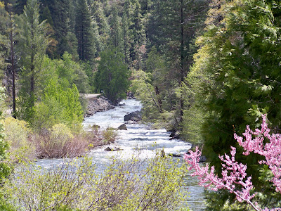
The South Fork Kings River is an important tributary of the Kings River in the U.S. state of California. It joins the Middle Fork Kings River to form the main stem of the Kings. It is famous for flowing through Kings Canyon, a 10,000-foot (3,000 m) deep glacial canyon in the heart of Kings Canyon National Park.
Here's a video of Roaring River Falls.

Pulling up Anchor at Acadia National Park

 I thought it would be nice to add a few facts about Acadia National in each of the photos below. We decided that our last trip here at Acad...