Wednesday, May 31, 2017

Day 1 of 5 - Grand Canyon Rim to Rim (R2R) Hike - May 26, 2017 North Rim To Cottonwood Campground


Here we are gearing up at the North Kaibab trailhead.  At the trailhead, you are standing on the Kaibab Plateau at an elevation of 8,250 feet. Approximately 1300 feet higher than the South Rim. We both started with 30-32 pounds each in our backpacks.


The trail winds down the canyon 14.2 miles to the Bright Angel Campground.  Our trek today will take us approximately half that distance to the Cottonwood Campground. 


The first 4.7 miles leads down to Roaring Springs Canyon.  From mid-May through October, restrooms, and water may be available along the trail at Supai Tunnel, the Roaring Springs, Manzanita Rest Area and Cottonwood Campground.    During our hike water at Supai Tunnel was not available.  It's crucial that hikers check to see where water is available prior to beginning any hike down the canyon.


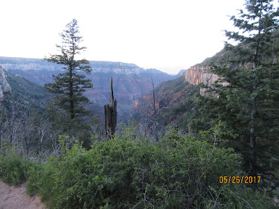
Our first stop is Coconino Overlook about 1.4 miles down the trail. It's a great place to stop, soak in the view and have a snack before proceeding down the canyon.


The word Kaibab means "mountain lying down" in the language of the Southern Paiutes.  This photo shows how far we have come down the canyon so far.  We are less than 2 miles down at this point. 


If you click on this photo to enlarge it, you can see one section of the main water line which provides essential water to the North Rim.  Roaring Springs has been the source of water for the North Rim since 1928.  Heavy rains frequently cause mud and debris slides that damage these lines which must be repaired as quickly as possible.  Every hiker must be prepared just in case water is not available on the trail. 


At 2 miles we reach the Supai Tunnel.  The Civilian Conservation Corps blasted this tunnel in the 1930's when this trail was built to replace the old Bright Angel Trail.  


In the middle of this photo, you can see the bridge in the Redwall.  The construction of this bridge took place after a major flood in 1966 which wiped out much of the North Kaibab Trail


We finally arrive at the Redwall Bridge at 5.4 miles. The Bridge traverses Roaring Spring Canyon.    Notice the Ponderosa Pine to the right of Kathy.  This tree is growing nearly 1000 feet below their range.  If the conditions are right, the seeds will germinate which means the plant's minimum requirements are met and life begins.  


The Needle.  This section was blasted through the sheer Redwall Limestone.  During this section, you transverse narrow pathways that will make your hair stand up on end.  If you fall, it will be fatal.   Here is a link to Kathy's video that shows just how dangerous this path becomes.  https://www.facebook.com/kathy.s.cramer/posts/1319682961414001?pnref=story


 The white spot in the middle of the photo is Roaring Springs.  We are down 5 miles into the canyon. You can hear it way before you see it!  It is the lifeline of the North Rim.


The Manzanita Rest Area elevation at 3840 feet.  This is the location of the pump house which provides water to the North Rim and a well-deserved rest area for weary hikers.  We took about a 20-30 minute break before continuing to Cottonwood Campground. 


The park established Cottonwood Camp, elevation 4200 feet, in the 1920's as a layover for mule parties coming down from the North Rim.  The mules now only go to the Supai Tunnel and return to the top.  I am sure Kathy will provide a detailed analysis of our hike in the near future.  


A look back up to the top from Cottonwood Camp.  At night, you can see the lights of the Grand Canyon Lodge on the North Rim.  The Lodge is on the light colored peak in the center of the picture just above our backpacks hanging on the pole.


This is me, I developed significant pain in my thighs on way down the canyon.  I was definitely second guessing my immediate future.  Kathy, in the meantime, was in full blown panic mode.  After speaking with the Ranger, I proceeded to soak my legs and thighs in the creek that sits adjacent to the campground.  I had two choices; retrace our steps back up out of the Canyon or continue our journey.  I decide to continue our journey in the hope that things would get better!  Day 2, 3 and 4 posts coming soon.  


A couple of facts you might not know about the Grand Canyon

WE DON'T REALLY KNOW HOW OLD IT IS

It has long been believed that the Colorado River began carving the Grand Canyon about 6 million years ago, but a 2012 study contained a real shocker, suggesting that the process may have begun as far back as 70 million years. In all likelihood, the Grand Canyon as we know it today started out as a series of smaller canyons 70 million years ago, but the majority of the canyon did not begin to take shape until much more recently.


THE GRAND CANYON CREATES ITS OWN WEATHER


Of all Grand Canyon facts, this one is pretty cool – no pun intended. Sudden changes in elevation have an enormous impact on temperature and precipitation, so the weather you're experiencing could vary drastically depending on where you are in the Grand Canyon. The coldest, wettest weather station in the region is the Bright Angel Ranger Station on the North Rim, while the hottest (and one of the driest) is just 8 miles away at Phantom Ranch.


Sunday, May 21, 2017

Mt Charleston - NV


Mount Charleston, officially named Charleston Peak, at 11,916 feet, is the highest mountain in both the Spring Mountains and Clark County, in Nevada.  It is located about 35 miles northwest of Las Vegas within the Mount Charleston Wilderness, which is within the Spring Mountains National Recreation Area of the Humboldt-Toiyabe National Forest.


We would have loved to have hiked the Cathedral Rock Trail which is about is 2.7 miles in length but we decided that the canyon hike was more important and we did not want any injuries that could jeopardize our rim-to-rim hike.  


Here is the trail map for the short but steep hike.  


Click on this photo to enlarge and you can see two people to the right of the green bush at the top. 


When we started back down the mountain you could see some of the houses and hotels along the route. 


And yes there is a Deer Creek highway. 


Another hotel along our drive.  


This is the road leading up to the Mt Charleston Ski Resort. The resort is located at 8,500 feet elevation in the lush landscape of Mount Charleston. With 445 acres of terrain, four lifts, 30 trails and a terrain park, the resort is a great destination for those wanting to ski or snowboard.


 This photo shows the road up to Lee Canyon. The Lee Canyon Ski Area was created in 1964 when the Forest Service issued a Special Use Permit in order to provide winter recreation options in Southern Nevada. During the 1960s, the Las Vegas gaming industry was booming, and winter sports enthusiasts were pleased to find a high alpine environment in the middle of the desert, only one hour away from the Las Vegas Strip.


The Desert View Overlook is a popular stop along the Deer Creek Highway (NV 158).  


Interpretive panels along the pathway that provide extensive interpretation of the Cold War atomic testing that occurred within sight of the overlook, as well as local geology. If your timing is right you may be able to catch sight of the tip of Creech Air Force Base and the town of Indian Springs just over a ridge. This is where the Air Force trains and operates drone aircraft.


After about 1-2 minutes of walking, the trail ends at the first overlook with a grand view to the north. During the 1950’s, the Mount Charleston area was designated by the Atomic Energy Commission as being the best vantage point for spectators to watch the United State’s A-bomb tested within sight of the overlook.  


On eight separate days in 1957, testing was announced far enough in advance for tourists to plan their vacations to coincide.  Vast crowds assembled up here to watch the explosions. Metal poles erected to hold official cameras recording the events still stand just below the viewing platform. These photos were taken from the viewing point. These days, you have to settle simply for a vast desert panorama.,


During the 1950s, the mushroom clouds from the 100 atmospheric tests could be seen for almost 100 mi (160 km). The city of Las Vegas experienced noticeable seismic effects, and the distant mushroom clouds, which could be seen from the downtown hotels, became tourist attractions.


The nuclear weapons tests of the United States were performed between 1945 and 1992 as part of the nuclear arms race. The United States conducted around 1,054 nuclear tests by official count, including 216 atmospheric, underwater, and space tests.[1] Most of the tests took place at the Nevada Test Site (NNSS/NTS) and the Pacific Proving Grounds in the Marshall Islands and off Kiribati Island in the Pacific, plus three in the Atlantic Ocean. Ten other tests took place at various locations in the United States, including Alaska, Nevada other than the NNSS/NTS, Colorado, Mississippi, and New Mexico.


Underground tests in the United States continued until 1991 (its last nuclear test), the Soviet Union until 1990, the United Kingdom until 1991, and both China and France until 1996. In signing the Comprehensive Nuclear-Test-Ban Treaty in 1996, these states have pledged to discontinue all nuclear testing; the treaty has not yet entered into force because of failure to be ratified by eight countries. Non-signatories India and Pakistan last tested nuclear weapons in 1998. North Korea conducted nuclear tests in 2006, 2009, 2013, and 2016. The most recent confirmed nuclear test occurred in September 2016 in North Korea.


Wednesday, May 10, 2017

Training for our upcoming Grand Canyon Hike - May 2017


Sunset at Kirtland AFB Fam Camp in Albuquerque, NM.  Although we did walk 3-4 miles twice a week in Florida, most of the walks were on level ground.  Our goal was getting used to carrying 20-25 pound packs on our backs.  Our goal here in Albuquerque was to increase our distance and also add some elevation to our hikes.   


This photo shows the city of Albuquerque in the far background,  You start your hike from one of multiple parking lots.  We decided to select a hike that was comparable to our second day hike from Cottonwood CG to Phantom Ranch.  The hike is about 7 miles with minor elevation change.  This hike was 6.8.miles and provided multiple up and down routes.  


The Sandia Mountains offer a wide range of hiking as well as other recreational actives including more than 20 hiking trails close to the base.    


We enjoyed the hike so much that we did it again two days later.  The elevation was 6400 feet which is very close to that of the South rim of the Grand Canyon. 


    We began our hike at 7:20 in the morning and hiked 3.4 miles to a rest area where we 
had our PBJ sandwich and took a 20-minute rest before we started our return trip.  This hike was considered a moderate hike.   We hiked at a 25-minute per mile pace.  The hike took us just over 2 hours.  

Pulling up Anchor at Acadia National Park

 I thought it would be nice to add a few facts about Acadia National in each of the photos below. We decided that our last trip here at Acad...