The Schoodic Peninsula is the only part of Acadia National Park found on the mainland of Maine. It takes about an hour drive from our campground to get here. We decided to hike three different routes today as a loop to get to Schoodic Summit - Anvil, Schoodic & Alder.

It is also managed by the national park services but has fewer visitors. It still boasts granite ridges, granite stairs and most features as other hikes we have completed in Acadia national park.

We also have to navigate many tree roots as well.

This trail rises abruptly uphill and downhill along our route.


The Bar Harbor, Maine cruise port is a tender port of call, meaning cruise ships anchor a short distance offshore and passengers are ferried to the port terminal in smaller tender boats. From our vantage point we also had views of Cadillac Mountain and Frenchmen's Bay.


A long wooden path to cross over a wet section on our return. It did rain a day earlier but not much accumulation.


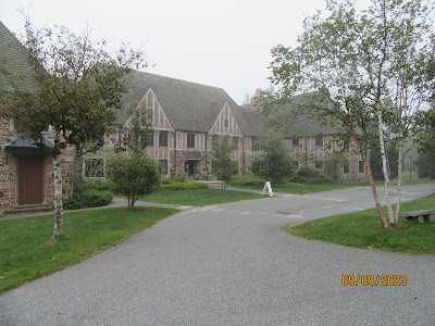
The Peninsula is also the home to the Schoodic Research Learning Center. A place for science learning in that it enhances the understanding of the natural and cultural resources of the National Park System. The building was converted from a closed Naval facility.

We have a few switchbacks on the way up the mountain.

Did I mention granite steps. Hiking down them is not my favorite part of the hike. It does hurt the knees.

We did have to hike down some trails only to hike back up again. The last .3 miles was decidedly uphill.
We finally arrive at the summit, but you have to travel to the overlook for the views which is another .2 miles.

View from the Overlook of the Winter Harbor Lighthouse built in 1856. It's now privately owned and not opened to the public.


Kathy found and photographed an 1860 geological marker near the overlook.

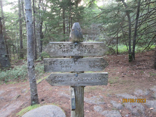
You can get confused with all the trail markers. I decided to point to our direction of travel on the way back.

We had to take the Schoodic Trailhead back to the Alder trail on our return.
A long wooden path to cross over a wet section on our return. It did rain a day earlier but not much accumulation.

We reach the Alder Trailhead. We have .6 miles to go.
After hiking up and down on the way up to the summit, we have a nice wide-open flat trail to complete our hike.

Our final totals for this hike.

The Peninsula is also the home to the Schoodic Research Learning Center. A place for science learning in that it enhances the understanding of the natural and cultural resources of the National Park System. The building was converted from a closed Naval facility.